 |
Home | Charity | Feedback |
Panama: Panama City
Panama City, Panama: Bridging the oceans by Prakash Bang, Editor in Chief 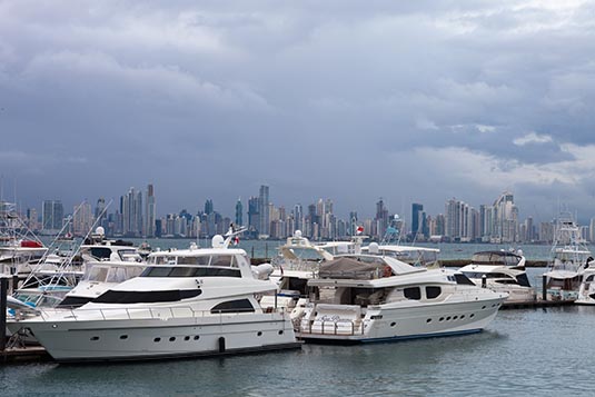 Panama City was the starting point for expeditions that conquered the Inca Empire in Peru. It was a stopover point on one of the most important trade routes in the American continent, leading to the fairs of Nombre de Dios and Portobelo, through which passed most of the gold and silver that Spain took from the Americas. On its shores is the impressive Panama Canal, which connects the Atlantic Ocean with the Pacific Ocean. The canal is country's principal exchange earner and major tourist attraction. 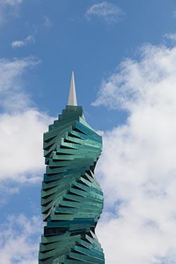 I was leading a group of friends for a 15-day journey through Central America. Our first stop was Panama City and thereafter we would travel through Costa Rica, Nicaragua and Guatemala.
I arrived late afternoon in Panama City. It was a long flight from my home in India. We were booked at Hotel Hilton, overlooking the Panama Bay. My room, which was on a high floor offered excellent view of the busy city life below and the Pacific Ocean beyond. Few of the members would be arriving the next morning. It was thus prudent to begin our exploration of the city next day afternoon. For our stay and excursions in Panama we availed the services of EcoCircuitos Panama, a local tour company. We were quite happy with their efficiency and the tour guide at our disposal. With a day and half on hand, our plan was to walk the Old Town in the afternoon and spend the next day on the Panama Canal. Panama City was founded on August 15, 1519 by Spanish conquistador Pedro Arias Davila and it lasted one hundred and fifty-two years. In January 1671, the Governor Juan Perez de Guzman had it set on fire, before the attack and looting by the pirate Henry Morgan. In 1672, Antonio Fernandez de Cordoba initiated the construction of a new city, which was then founded on January 21, 1673. This city was built on a peninsula completely isolated by the sea and a defensive system of walls. Today this place preserves the first institutions and buildings of the modern city of Panama. It is known as Casco Viejo (Spanish for Old Town). It is also known as Casco Antiguo or San Felipe. 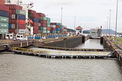 Our bus dropped us on the edge on the Old Town. From there onwards we would walk the town for a few hours.
Casco Viejo is the historic district and cultural gem of Panama City. Declared a World Heritage Site by UNESCO in 1997, Casco Viejo was established by the Spanish colonialists, the Catholic Church, and other settlers. Historically one of the richest and most densely populated neighborhoods in the Americas, Casco Viejo went on to experience decades of neglect around the 1950s. The streets are filled with buildings that served as homes, cathedrals and churches and government buildings over centuries and many architectural phases. Some of these structures have been painstakingly restored and now house museums, gourmet restaurants, quaint shops and upscale residences. Other buildings stand in disrepair or complete ruin and the homes of poor families juxtaposed next door with a remodeled, exclusive property offer a an excellent peek into the varied history that the district has experienced. 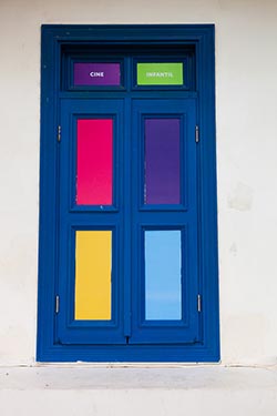 For the buffs, they can easily spend days in this neighbourhood alone. But for tourists like us its only hours to fathom the spirit. Some of the attractions we visited include:
Plaza Francia. Originally the main square of the walled city, Plaza Francia was designed by Leonardo de Villanueva and is dedicated to the French effort to build the Panama Canal and the thousands of people from around the world who died during the process. La Iglesia De La Merced. The construction of Iglesia de la Merced dates back 1680 and the beautiful baroque facade was brought over stone by stone from Panama Vieja, the original city center founded by the Spaniards. Iglesia De La Compania De Jesus. The Iglesia de la Compania de Jesus and surrounding buildings were constructed around 1741 to accommodate a school and were later turned into a university. The church was destroyed by a fire in 1781 and further damaged by an earthquake in 1882. 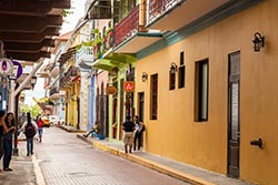 Iglesia San Francisco de Asis. Iglesia San Francisco de Asis is one of the smallest but most ornate churches in Casco Viejo. It sits on Plaza Bolivar across the street from the National Theater.
Iglesia Santo Domingo. Originally constructed in the 17th century, the church and convent of Santo Domingo were never rebuilt after a fire that destroyed them in 1756. The only thing that did survive – for centuries – was the Flat Arch (Arco Chato) sitting at the entrance. Iglesia San Jose. The main attraction at the Iglesia de San Jose is the famous Altar de Oro (Golden Altar) which was miraculously saved after the sacking of Panama Viejo. 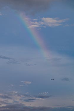 Plaza Bolivar. Plaza Bolívar is a small plaza surrounded by 19th-century architecture and is one of the most pleasant places in Casco Viejo, day or night. The plaza gets little road traffic and is trimmed with cafes and restaurants outfitted with large and colourful umbrellas. Street artists are seen flaunting their talents.
That evening the group dispersed for dinner. We were on our own to dig into our favourite cuisines. After breakfast, the next morning, we drove to Amador Causeway. After exploring the neighbourhood we then drove to Gamboa Dredging Division which is half-way between the two oceans. From here we would board our ship to commence our partial transit of the Panama Canal. Built in 1913, with rocks from the excavation of the Culebra Cut during construction of the Panama Canal, the Causeway joins Panama City with four islands: Naos, Perico, Culebra and Flamenco. The site was part of a US military complex called Fort Amador that had established to protect the Pacific entrance to the Panama Canal. Currently, vestiges of the military installations can be seen on the islands. 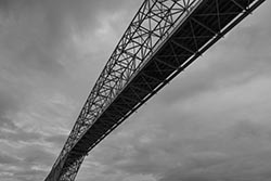 The Amador Causeway is the second longest boardwalk in the city. It has a varied selection of national and international restaurants, nightclubs and Frank Gehry's famous Biodiversity Museum. Its open parks and its bike, roller skate and skateboard rental stations, are an invitation to participate in outdoor activities.
While there's an option for tourists to do the coast to coast canal crossing; I think it's a good idea to do just the partial trip. It gives all the experience. Depending upon the day and the Panama Canal Authority, one could either be northbound or southbound. So you would either get 'down the canal' or 'up the canal' experience. 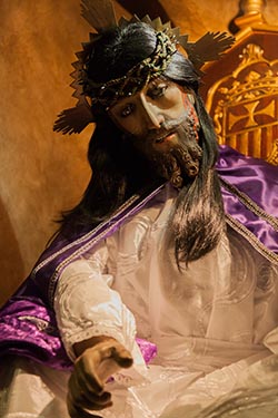 Panama Canal (Canal de Panama in Spanish) is a lock-type canal, owned and administered by the Republic of Panama. It connects the Atlantic and Pacific oceans through the narrow Isthmus of Panama. The length of the Panama Canal from shoreline to shoreline is about 40 miles (65 km) and from deep water in the Atlantic (more specifically, the Caribbean Sea) to deep water in the Pacific is about 50 miles (82 km).
The canal, which was completed in August 1914, is one of the two most-strategic artificial waterways in the world - the other being the Suez Canal. Ships sailing between the east and west coasts of the United States, which otherwise would be obliged to round Cape Horn in South America, shorten their voyage by about 8,000 nautical miles (15,000 km) by using the canal. Savings of up to 3,500 nautical miles (6,500 km) are also made on voyages between one coast of North America and ports on the other side of South America. Ships sailing between Europe and East Asia or Australia can save as much as 2,000 nautical miles (3,700 km) by using the canal. 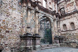 From its opening in 1914 until 1979, the Panama Canal was controlled solely by the United States, which built it. In 1979, however, control of the canal passed to the Panama Canal Commission, a joint agency of the United States and the Republic of Panama, and complete control passed to Panama at noon on December 31, 1999. Administration of the canal is the responsibility of the Panama Canal Authority which answers solely to the government of Panama.
The Panama Canal lies at a latitude of 9° N, at a point where the North American Continental Divide dips to one of its lowest points. The canal does not, as is generally supposed, cross the isthmus from east to west. It runs due south from its entrance at Colon on the Atlantic side through the Gatun Locks to a point in the widest portion of Gatun Lake; it then turns sharply toward the east and follows a course generally to the southeast until it reaches the Bay of Panama, on the Pacific side. Its terminus near Balboa is some 25 miles (40 km) east of its terminus near Colon. Parallel to the canal are the Panama Canal Railway and the Boyd-Roosevelt Highway. 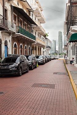 In passing from the Atlantic to the Pacific, vessels enter the approach channel in Limon Bay, which extends a distance of about 7 miles (11 km) to the Gatun Locks. At Gatun a series of three locks lifts vessels 85 feet (26 metres) to Gatun Lake. The lake, formed by Gatun Dam on the Chagres River and supplemented by waters from Alajuela Lake (Lake Madden; formed by the Madden Dam), covers an area of 166 square miles (430 square km). The channel through the lake varies in depth from 46 to 85 feet (14 to 26 metres) and extends for about 23 miles (37 km) to Gamboa.
Gaillard (Culebra) Cut begins at Gamboa and passes through the Continental Divide. The channel through the cut has an average depth of about 43 feet (13 metres) and extends some 8 miles (13 km) to the Pedro Miguel Locks. The locks lower vessels 30 feet (9 metres) to Miraflores Lake, at an elevation of 52 feet (16 metres) above sea level. Vessels then pass through a channel almost 1.2 miles (2 km) long to the two-stepped locks at Miraflores, where they are lowered to sea level. The final segment of the canal is a dredged approach passage 7 miles long through which ships pass into the Pacific. Throughout its length the canal has a minimum bottom width of 500 feet (150 metres); in Gatun Lake the width of the channel varies between 500 and 1,000 feet (150 and 300 metres), and in Miraflores Lake the width is 740 feet (225 metres). 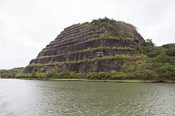 Our bus was waiting for us at the ferry terminal. Dinner that night was at an Indian restaurant located in a mall just next door.
The next afternoon we would take our flight to San Jose in Costa Rica. The morning was free to explore Calle 50, a busy street cutting across the business and financial districts of Marbella and Obarrio. Panama City Image Gallery  Photo viewer Photo viewer
|
|
|
Home |
Charity |
Feedback
Privacy Policy | Terms of Usage © YoGoYo.com. All rights reserved. |


