 |
Home | Charity | Feedback |
North Pole:
The Expedition,
Arctic Ocean,
Barents Sea,
Cape Tegetthoff,
Champ Island,
Franz Josef Land,
Ninety Degrees North
Franz Josef Land: On one of the many islands by Prakash Bang, Editor in Chief 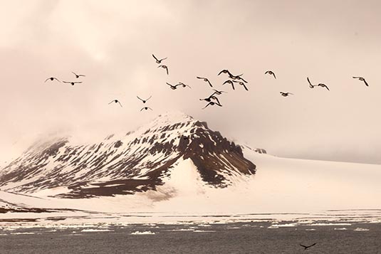 Franz Josef Land, is an uninhabited archipelago located in the Arctic Ocean, Barents Sea and Kara Sea, constituting the northernmost part of Arkhangelsk Oblast in Russia. It consists of 191 islands, which cover an area of 16,134 square kilometers, stretching 375 kilometers from east to west and 234 kilometers from north to south. 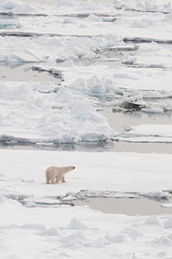 The islands are categorized in three groups, western, central and eastern, separated by the British Channel and the Austrian Strait. The central group is further divided into a northern and southern section by the Markham Strait. The largest island is George Land, which measures 2,741 square kilometers, followed by Wilczek Land, Graham Bell Island and Alexandra Land.
Eighty-five percent of the archipelago is glaciated, with large unglaciated areas being located on the largest islands and many of the smallest islands. The islands have a combined coastline of 4,425 square kilometers. Compared to other Arctic archipelagos, Franz Josef Land has a high dissection rate of 3.6 square kilometers per coastline kilometer. Cape Fligely on Rudolf Island is the northernmost point of the Eastern Hemisphere. The highest elevations are found in the eastern group, with the highest point located on Wilczek Land, 670 meters above mean sea level. The archipelago was first spotted by the Norwegian sealers Nils Fredrik Ronnbeck and Johan Petter Aidijarvi in 1865, although they did not report their finding. The first reported finding was in the 1873 Austro-Hungarian North Pole Expedition led by Julius von Payer and Karl Weyprecht, who named the area after Emperor Franz Joseph I. The islands were annexed by the Soviet Union in 1926, who settled small outposts for research and military purposes. Norway rejected the claim and several private expeditions were sent to the islands. With the Cold War, the islands became off limits for foreigners and two military airfields were built. The islands have been a nature sanctuary since 1994 and became part of the Russian Arctic National Park in 2012. 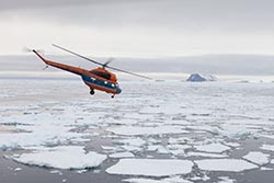 Post breakfast we had plans to do a morning landing at Cape Figley on Rudolf Island. However, due to dense fog, there was no way for the helicopter to take off or land. We were anchored till about 5 in the afternoon, when the fog lifted. For a safe helicopter flight, it is necessary for the fog to be at least 100 feet above the sea. The helicopter pilot was ready to land us on Bear Mountain at Cape Figley. By the time we took off it was 7 PM. The ride to the mountain top was just a few minutes.
This is a site of an Orthodox memorial cross with a copper plaque, to the Russian Polyarniks installed about 1998. The cape is the most northern point of the archipelago, indeed the most northern outpost of the European continent. 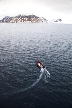 My group was the first to take off. 5 people would go on the helicopter. The plan was to drop the first 5 and come back for the next. We were allocated about 60 minutes on the mountain. The helicopter would ferry till all the guests had the opportunity to land.
9 of my group members and 4 others along with the guards and the members of the expedition team were on the mountain, when the weather suddenly changed. Fog set in and there was no way for the helicopter to fetch us. The wind was fierce… about 15 knots. As per the expedition members, we could be stranded for a few hours and if unlucky, a few days! For the first couple of hours we walked around and danced to keep ourselves warm. Gradually, it was becoming unbearable. And there was no sign of the weather improving. When we landed we could see our ship anchored about 2 kms. away. Now, we could see nothing beyond a few feet. The team leader decided that we climb down the mountain on the other side for a couple of hundred feet so that we could be protected from the wind. For protection, we had just a plastic sheet. Unfortunately, there was no food or water with us. From the other group there was an old lady. She had to be wrapped in a sleeping bag; whilst other just bundled inside the plastic wrap.  Thanks to the navigation skills of the captain of our ship, he sailed quite near the mountain. Finally, after 6 hours of ordeal, the fog lifted a bit and the chopper could reach us. Thankfully, there were no casualties… all is well that ends well. We were awarded a ‘Bravery Certificate’, if I may, for spending the night out on a God forsaken location!
The log at 12 noon on day 8: Location: 82º 41’ N, 53º 22’ E Wind speed: 6 knots Temperature: 2.4 degrees C; heavy fog Distance from North Pole: 439 NM Franz Josef Land Image Gallery  Photo viewer Photo viewer
|
|
|
Home |
Charity |
Feedback
Privacy Policy | Terms of Usage © YoGoYo.com. All rights reserved. |


